KANSAS CITY, Mo. — We’re Weather Aware from 4 – 9 p.m., on Tuesday for the possibility of severe storms later in the day. The main “Enhanced” threat (3/5 SPC categories) remains well to our NW. The metro area is under a “Slight” risk (2/5.)
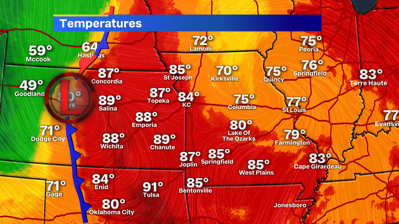
Here’s the reason for the dynamic setup this afternoon. An incredible temperature gradient near a cold air mass and two distinct fronts. A boundary ahead of this low will aid in our storm development later this afternoon. Those closer to the low and a bit north will see a greater likelihood for tornado development this afternoon, but that doesn’t rule it out for portions of the metro later today.
These storms won’t likely develop as a very large and widespread line. They’ll likely develop in a singular fashion before coming together in more of a line.
This type of development often lends itself to that brief “spin up tornado” term you’ve probably heard us mention in the last few weeks. There have been a few of these tornadoes that last under five minutes and are rated EF-0 on the damage/wind scale. They’re still wind gusts between 70-85 mph, so it’s something to be taken seriously. I just wanted to take a second to explain that a bit more because it’s something we have used. Personally, I’m not a fan of the “isolated” tornado phrase because it downplays it a bit, but that’s another story for a different day.
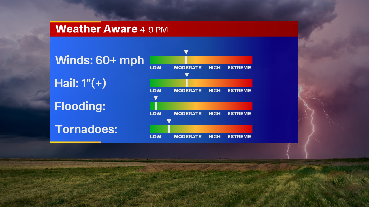
Our primary threat is probably going to be some larger hail and gusty wind damage with any of these storms that develop. This will be a very brief window this afternoon and evening. Once the wind shifts, our severe window closes. It will begin to cool down significantly and more of a gentle rain moves in overnight with gusty, non-thunderstorm wind. We’ll keep you posted if any watches/warning are issued later today.