Yup back at it…well sort off. Today is my last day of vacation then I’ll be back at work officially tomorrow. Vacation schedules during the summer are pretty crazy. Things change a lot from week to week. All of us have time off between now and the end of September so lots of rotating weathercasts coming up. It’s summer and it really is feeling like it out there. More on that plus some vacation pictures in today’s weather blog.
Forecast:
Today: Hot and humid with highs into the 90s. Heat index near 100°
Tonight: Fair and muggy with lows near 70°
Thursday: Hotter with more humidity=higher heat index values. Highs near 95° with heat indices between 100-110° depending on your location.
Discussion:
Well the folks who enjoy the summer heat an humidity are in hog heaven…and it will basically be like this for quite some time. There will be chances of rain every so often. These heat domes typically wobble around the Plains and SW part of the country. These wobbles sometimes allow thunderstorms to wobble our way from various areas. So I don’t think it will be totally dry from now through the early part of next week. It should though be mostly dry.
With conditions being so green and with all the rain we’ve had over the last couple of months…it will take some time to bake out the ground. The green terrain combined with the sunshine and more of a southerly wind flow…all mean higher and higher dew point levels. This means that with temperatures near 95° and dew points near or above 70°…heat index values will be nasty. Not really unusual for the early summer months…but perhaps a bit early.
This is a reminder from the NWS in Dallas (it applies to us here in KC for most of the next 7 days or so). Use common sense and for those who are more sensitive to the heat…be more alert to how your body is reacting to it.
Heat can be deadly! Know the signs of heat stress. Heat Advisory for all of N. and Central TX through Thur. #txwx pic.twitter.com/uD7v77T5oW
— NWS Fort Worth (@NWSFortWorth) June 15, 2016
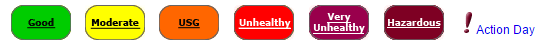
Also a reminder that we have the potential of higher and higher ground level ozone issues. For some folks this too creates issues…here is the latest ozone situation. There is a bit of a lag from the current time to the time this graphic is updated.

We should teeter into the ORANGE range today…which is USG or Unhealthy for Sensitive Persons
My colleagues at the NWS have put this graphic together…

They also will be issuing a variety of advisories and/or warnings concerning the heat. DON”T get caught up in that jargon. They’re confusing and most don’t understand the differences. Heat is typically the #1 weather related killer year in and year out in the KC area. Not tornadoes…floods…lightning…cold…or anything else…it’s the heat. TV stations though won’t do wall to wall coverage of the heat though…for obvious reasons…but it’s the biggest issue in KC in terms of what potentially will affect you hour by hour during the day.
The typical cause of these stretches of hot weather…and again we’ll be running about 10° or so above average for highs…are upper level “anticyclones”. There are the opposite of “cyclones” or storms in the atmosphere. Instead they generate vast areas of sinking air. This sinking air then is heated as it slowly sinks through the atmosphere. The mid-late June sunshine also contributes to a hotter and hotter air mass.
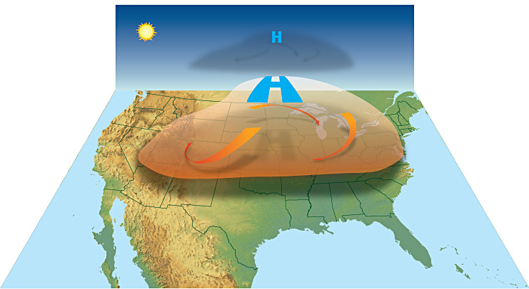
The broad circulation around the HIGH just keeps recirculating the heat and humidity around the Plains. These highs wobble around as mentioned…as they do the most intense heat can wobble around as well.
For example heading towards the weekend the core of the heat will enable areas in the SW part of the country to threaten mostly and potentially all-time record highs as the core of the HIGH drops more towards the SW part of the country.
Folks there are being alerted to the likelihood of 115-125° heat…

I just returned from there and it was basically 100-105° which was doable from my point of view. Hot sure…but with reduced dew points. When the dew points crept up…it did get to be more uncomfortable.
Now about our rain chances. They are there. As these circulations wobble around…we sometimes edge back into a somewhat NW or WNW flow aloft. This can allow storms which form along weak cold fronts in NE/IA move towards the area. These storms then put down outflows which can create additional thunderstorms with all the heat that’s around. There will be some weak fronts in the region…one on Friday and another perhaps on Tuesday. So something can happen with those fronts in the area. How much actual “cool” air can work into the region though…is rather iffy. There may be a day or two over the next 5-10 days closer to 85° or so for highs…but the more common highs appear to be in the 90s unless something bigger can penetrate the region.
As I mentioned at the top of the blog…just got back from the Phoenix and Sedona area…with a side trip to Jerome, AZ. To cool off in AZ…many had up towards northern AZ…around the Flagstaff and Sedona areas where the elevation helps to cool things down. To take that to the extreme some head up even higher in elevation to the San Francisco Peaks. This is where the AZ Snowbowl ski resort is located. They get over 250″+ of snow. We took a ski lift up to 11,500 feet. actually snow snow pockets of snow in the shaded areas to!

The view from where we came from was fascinating…

Follow the clearing line in the trees to see the path we took.
It was about 55° or so with 20 MPH winds at the top of the mountain. Refreshing to say the least. The views though were amazing and I’ll post a couple of those pictures tomorrow.
Joe


