Well no doubt about it…the month is starting hot. The mornings have been nice but you can definitely feel it more in the afternoon and today will be no exception to that.
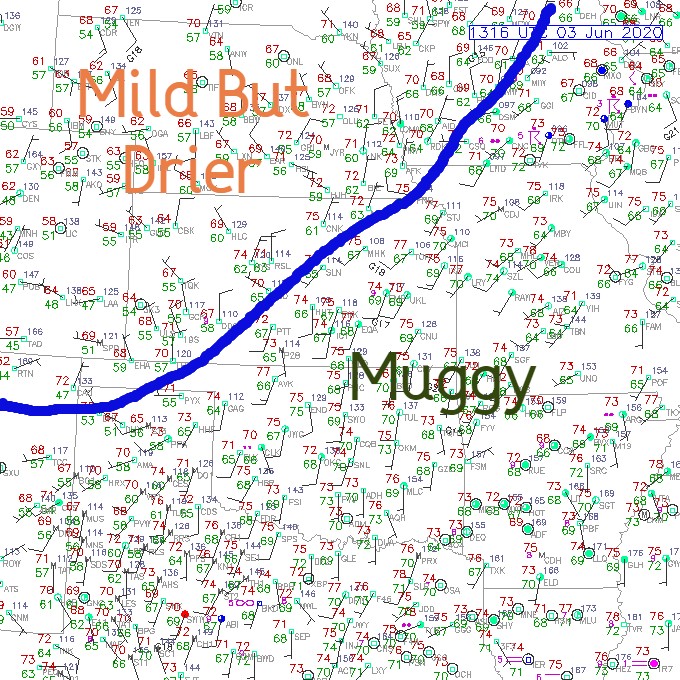
Dew points are up to mid summer levels…and temperatures are following suit. Now add in a front (weak at best) and the potential of storms increases today. The activity later this afternoon may not be widespread at all though…and perhaps will favor areas more on the MO side, but another actually disturbance may come our way overnight…and that could bring some more widespread rain into the area.
____________________________________________________________
Forecast:
Today: Mostly sunny, hot and humid with highs approaching 90°. Heat indices will be in the mid 90s. Scattered storms may develop after 3PM…especially on the MO side. IF that happens, coverage may not be very widespread but the storms may have some gusty winds/hail with them in localized areas.
Tonight: The evening should be OK but later tonight into the wee hours of the morning storms may come into the area from the northwest. Some gusty winds are possible with these storms depending on how well they hold together.
Thursday: We should be stabilized and we may be a few degrees cooler too. Highs in the mid 80s
Friday: There may be some sort of complex in the early morning…then we should be OK for the rest of the day. Getting hotter again…with highs well into the 80s
_________________________________________________________________
Discussion:
Complicated forecast because of the different variables out there. Today is more simplistic in terms of the set-up. A cold front is to the north of the Metro early this morning and temperatures are going to heat up to near 90°. Dew points are going to be well into the 60s to near 70°. That means there will be a lot of instability building.
That front will ooze into the area today…and with the temperatures approaching (or exceeding 90°) a LOT of instability will be building. The front will be the trigger to this instability.
As the front drifts south…without a fully formed line of storms…it will slowly weaken and slow even more. In reality it may never make it through the Metro unless more storms come together and give it a shove southwards.
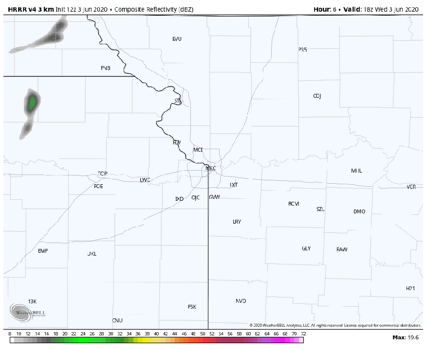
That means the storms will tend to be more scattered. The HRRR4 (newer version of the HRRR model) shows the almost isolated activity that may occur. The other issue is that the storms will also produce their own little rain cooled pockets of air that could trigger additional storms in the region. So at least the chance of storms will be around later today.
The CAPES…which help us look at instability are really high…later today…this is for 5PM
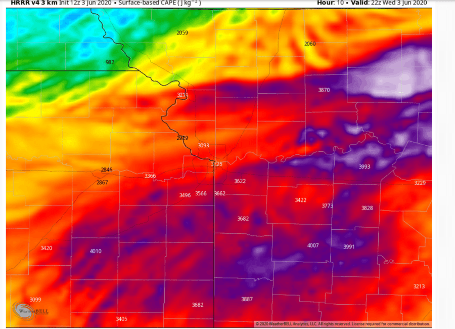
3000-4000 are high values for sure…so IF things can pop…local areas can get some severe weather…gusty winds and hail would be the main threats.
Then we should be calmer for the evening and through 12AM.
After that another opportunity comes this way…tied to a disturbance that may create storms in the Plains tonight and roll towards the region. That though is a bit murky because of how well the potential storms hold together…or not.
The model data isn’t so great with the set-ups today or tonight. There are various flags showing that the disturbance overnight tonight may be in a weakening state as it comes this way. The models are also NOT handling the atmosphere in a realistic way with all sorts of quirks in how the future areas of rain are moving and developing. So I’m not exactly trusting them too much at this point.
They do show potential though and the key will be what happens later today in the western Plains. On the assumption that something comes together…that would tend to roll this way. We’ll have to see how well it holds together as it comes in but we should get at least some rain from that and a decent rain cooled air mass that hopefully will linger through Thursday.
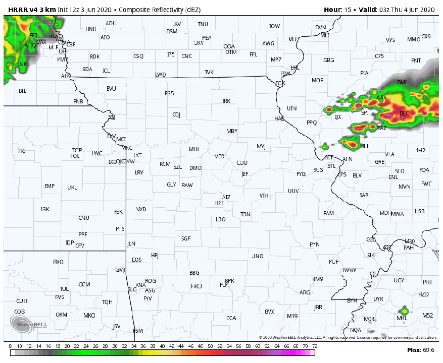
The overnight disturbance has the most potential of giving us some more widespread rain compared to the afternoon isolated to scattered storms.
Again all of this has triggered the SPC to place us under a “slight” risk of severe storms. Without stronger winds above the surface feeding into the complex tonight though I am questioning just how strong it will be when it comes through. IF the winds above us are stronger though that would be feeding the storms…and enabling them to maintain some semblance of strength as they come into the area.

So to recap…a BIG maybe for later today…and a better chance of something overnight after 1AM or so through 6AM.
Another chance of storms overnight Thursday into Friday AM and overnight Friday into early Saturday. We’ll deal with all that tomorrow and Friday.
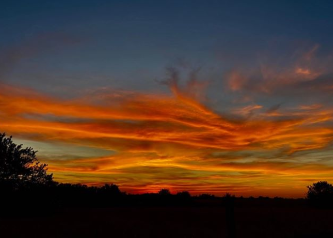
Our feature photo tonight is from Chip Houser of the great sunset from a couple of nights ago.
Joe