Several weeks ago I showed you a forecast calling for an above average month of June for temperatures and that will likely be an accurate forecast. We’re running an eye-popping 6° above average at almost the half-way mark and this is going to be a hot week…at least through Thursday and perhaps beyond depending on clouds and rain chances.
This week I”ll also be doing a blog or two regarding how the summers of changed around these parts over the past 50 years or so. I’ll be taking a deeper dive in what’s changed and perhaps what really hasn’t changed. They’ll be somewhat lengthy blogs and one will be posted tomorrow morniing.
__________________________________________________________________
Forecast:
Today>Wednesday: Mostly sunny and hot with highs 90-95°. Lows around 70-75°. A bit breezy at times. Slim to no rain chances.
There may be some scattered rain chances developing Thursday night into Friday. Can’t promise a lot of coverage at this point…perhaps something a bit better in northern MO. We’ll see what makes it down towards the KC Metro area.
___________________________________________________________________
Discussion:
So it’s been toasty. Nothing too crazy at this point really but more of a persistent run of above average temperatures.
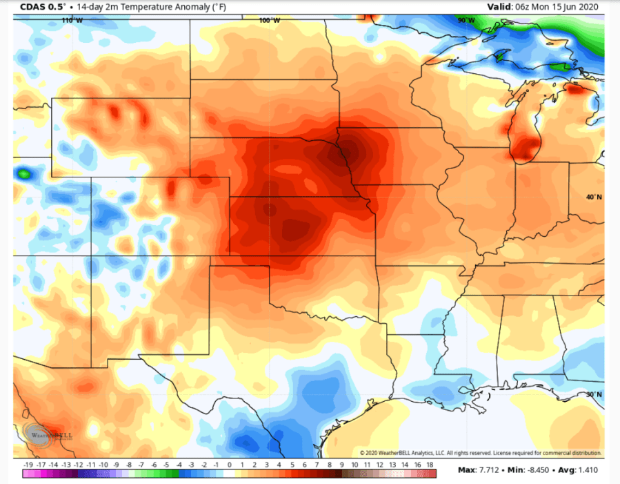
So far this month we’ve had 2 below average days…more of a function of the cooler mornings last week…because there has only been one day this month with high temperatures below average (the 10th)
So it’s been hot…and it’s really drying out out there too. Through yesterday we’re running almost 2″ below average…
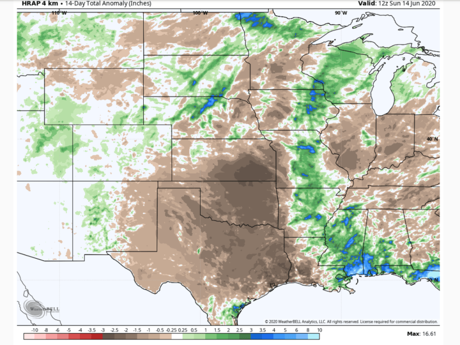
and we’re not alone. A large swath of the Plains and especially the southern Plains are getting dry…and getting dry fast. This weeks combination of a breeze…tolerable dew points and heat will really suck moisture out of the top soil. So the grass is going to start getting somewhat stressed this week if it’s not watered. Noticed this yesterday on the golf course and I’m starting to see some signs on my yard. We really haven’t had a good rain locally in a few weeks.
So when will it change? Well IF it doesn’t change this weekend…then I”ll start getting more concerned. Some long range data that came out last night had some concerning trends regarding the threat of a developing drought. I’m not sure I want to go there for our area specifically but I do have big concerns for areas out towards central and western KS and southwards into OK/TX.
As far as we go…our next rain chances will hinge on a slow moving front hat will be closer to the region later in the week. It may NOT make it through the region until later in the weekend BUT with the front between KC and the I-80 corridor it should at least spark off storms to the north of the area. Those storms will move east and perhaps southeast and could bring us some rain. How well they hold together during the overnight time frame as the atmosphere stabilizes remains to be seen.
At least though it will be a chance of rain…and we need that moisture.
I mentioned that we’re about 2″ below average for precip this month so far…last June we were in about the same boat though the 14th or so…after that though it got wet…with the 21st and 22nd of last June yielding 5″ of rain up at KCI…we ended up with over 7.5″ of rain for the month.
So things can change on a dime as we all know around here.
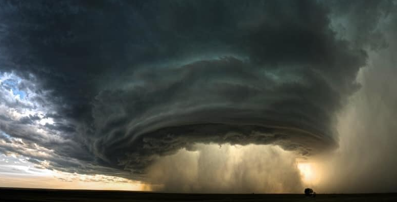
The feature photo comes from Lisa Venters Haugen up in SE Nebraska near Fairbury from about a week ago…great shot!
Joe