After a quiet next couple of days, we’ll see the pattern return to its wet, active state as a new system pushes closer to the KC metro. A cold front will sag down through the area and will stall out right over us, which will be the focal point for shower and thunderstorm development late Thursday, Friday, and even parts of Saturday.
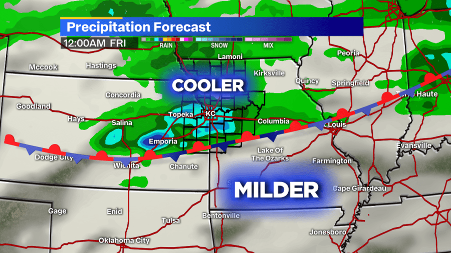
That stationary front will fidget around the area heading into the weekend, so we’re right expecting a constant, non-stop rain. But, showers will be in the area. In fact, conditions early Friday morning and afternoon could support some stronger storms.
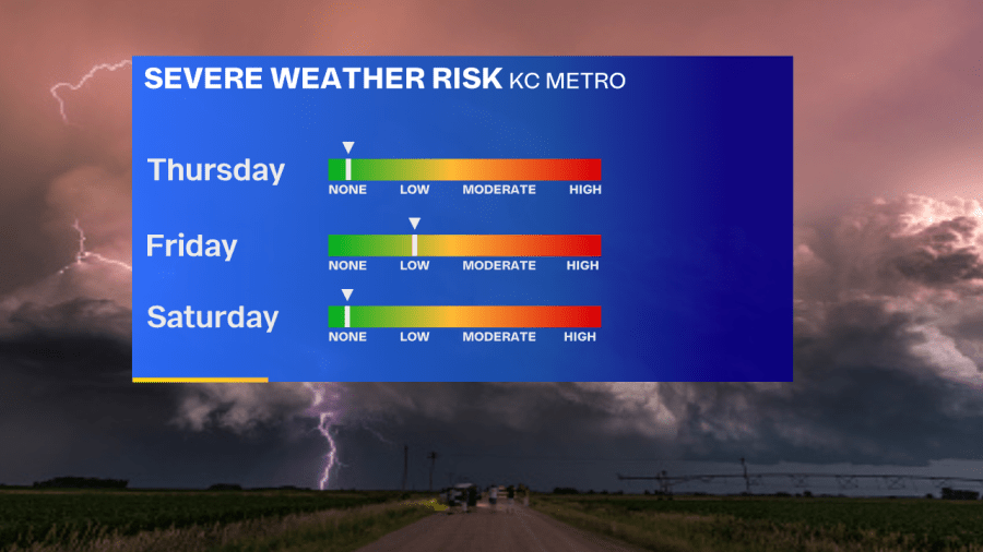
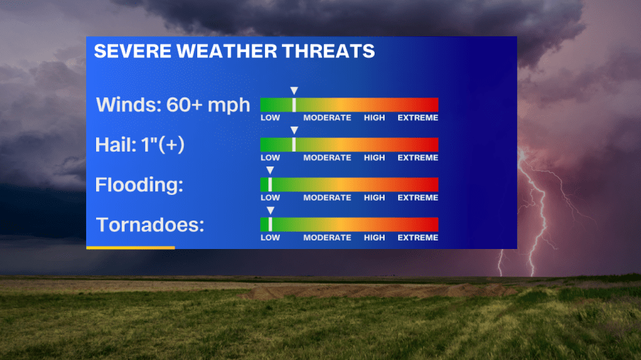
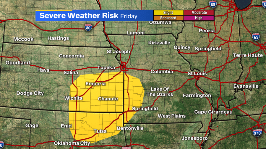
Any storms that do form on Friday won’t be widespread. At this point, we’re expecting the thunderstorms for the southern half of the viewing area, especially in Kansas and areas around the state line.
Stay with with the FOX 4 Weather Team as we continue to take a look at this next round of wet and active weather. Of course, when you’re away from your TV or we’re in between newscasts, download our FOX 4 Weather App so you are always up-to-date on severe weather alerts and forecasts!