Good Monday…it turned into a pretty good weekend overall. A mix of clouds and sunshine…yesterday temperatures made it up to around 80° or so. This week we’re going to heat up more…it’s going to feel like summer out there, especially tomorrow into the end of the week. Humidity levels will be climbing as this occurs. So the dreaded heat index will start to be in the weather news this week as well.
Overall though the main story, aside from the building heat will be the progress of a cold front that will be encroaching into the area sometime later Wednesday.
________________________________________________________________
Forecast:
Today: A mix of sun/clouds with temperatures in the lower>mid 80s
Tonight: Fair skies and mild…increasing winds too with lows well into the 70s
Tuesday: Mostly sunny and windy. Gusts to 30 MPH possible. Highs well into the 80s but with the higher dew points it will feel like the mid 90s
Wednesday: A front will be moving closer to KC later in the day. Storms are possible but not a guarantee right now for a couple of reasons. The main issue may be the timing of the front. Earlier in the day would reduce the storm prospects.
__________________________________________________________________
Discussion:
So here is something interesting from the NWS that I saw tweeted out yesterday. We’ve talked a lot about what seems to be a quiet May in the severe weather category.
1 tornado warning for the Pleasant Hill area of responsibility is pretty strong.
As a matter of fact…for the month of May…there wasn’t one “moderate” risk of severe storms in the country as a whole.

Look at the lack of activity in the Plains. Now as we transition to the month of June and into the summer months…the jet stream will typically shift farther and farther north. This brings the Plains threats farther north into the northern US and then into Canada.
As far as the week goes…again the trick to the forecast may be the front that will be nudging into the area this week. When it does…and how far south it gets will play a role in the rain chances around here. Some data has the front into the area in the morning on Wednesday. That would be an unfavorable time for storms around here, especially with pretty mild mid level temperatures creating a cap on the activity.
Other data has it later in the day with much more instability building. That with temperatures well into the 80s should be enough to trigger convection. There will be a cap as well in the afternoon IF the front is slower in arriving…but it’s breakable I think. The other issue and perhaps a reason why the models aren’t exactly going crazy with convection right now is that the won’t be much surface “convergence” in the area. SW winds to west winds head of the front and NW winds behind the front doesn’t allow the air masses to battle it out too strongly.
The GFS model is the one that is the most bullish with rain…not only Wednesday but into the end of the week as well because the front sort of stalls in the region.
Where the front actually stalls will be interesting to track because it’s going to lift back northwards…and while there “may” be a one day back off in the heat (that’s iffy on Thursday…the heat may return again Friday.
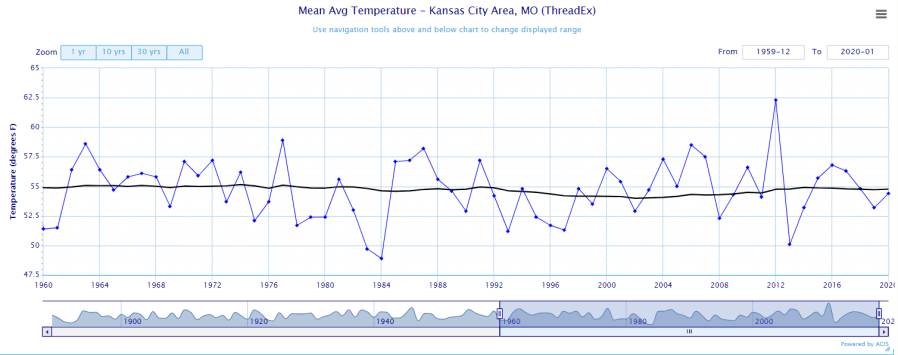
Before I leave you, and as we start a new month here is a look at how the Spring went. Remember in the world of weather, for statistics sake, we consider Spring…the 1st day of March to the last day of May. Here is where we stood…a Spring average of 54.4°. It was recently cooler in ’14, ’13, ’11, ’09, ’08 etc.

What is sort of interesting is how things have been tracking over the past 60 years…and using a 30 year moving average…despite all the ups and downs…the moving average has changed only 1/10″ of a degree since 1960 to the downside.
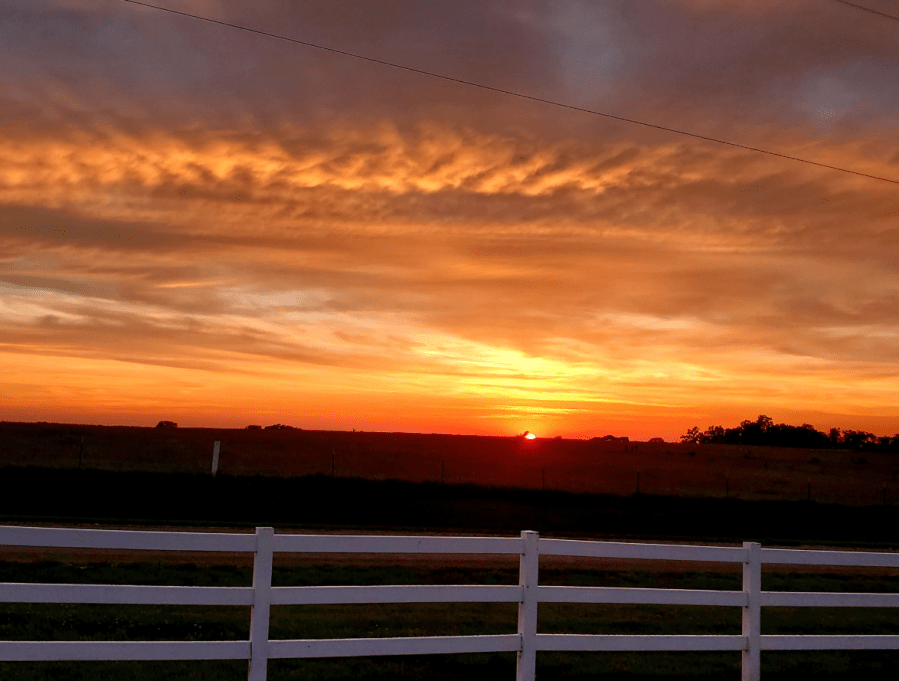
The feature photo comes from Chuck Nehring…taken the other day after all the rain.
Joe